


Irish thunderstorm warning
Ireland Braces for Unseasonal Thunderstorms as Met Éireann Issues Nationwide Warning
In a rare and urgent move, Met Éireann, Ireland’s national meteorological service, has issued a thunderstorm warning covering large parts of the country, citing a high risk of severe lightning, flash flooding, and strong winds over the coming days. The advisory marks one of the most comprehensive thunderstorm alerts Ireland has seen in recent years and reflects the increasing volatility of weather patterns affecting the island. As heavy clouds loom over coastal and inland counties alike, authorities are urging the public to take safety precautions, particularly in flood prone areas and regions with limited drainage infrastructure.
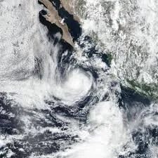
Typically known for its mild, maritime climate dominated by drizzle and overcast skies, Ireland is not generally associated with the kind of intense convective weather seen in continental Europe or the southern United States. However, recent summers have defied historical patterns, with thunderstorms becoming more frequent and intense, especially during warmer months. According to Met Éireann, the current warning is driven by an unstable atmospheric setup involving a combination of warm surface temperatures, moist air moving in from the Atlantic, and a cold upper trough passing over the country. This mix has created ideal conditions for towering cumulonimbus cloud formation, capable of producing powerful thunderstorm cells.
The warning covers several counties including Cork, Galway, Limerick, Kilkenny, and parts of Leinster, with forecasters predicting torrential downpours capable of dropping over 30 millimetres of rain in an hour. Localized flooding is a primary concern, particularly in urban centres where older drainage systems struggle to handle high volumes of rainwater in short periods. Surface water flooding, road hazards, and temporary power outages are all possible outcomes. Emergency services have been placed on high alert, with regional councils distributing sandbags and issuing guidelines to schools, nursing homes, and transport services to prepare for potential disruptions.
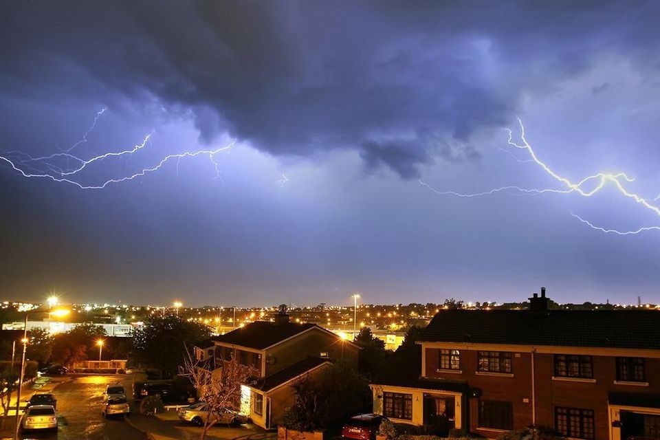
Beyond flash floods, the risk of frequent and intense lightning strikes has raised additional alarms. Lightning activity in Ireland is relatively rare, which means infrastructure and public awareness are not as robust as in countries where thunderstorms are common. Met Éireann has warned against outdoor activity, especially near open fields, golf courses, and bodies of water, where people are more exposed. Farmers, construction crews, and hikers have been urged to monitor real time updates and seek shelter during the peak storm periods. Additionally, the threat of hail and sudden gusts potentially exceeding 80 km/h in some regions adds to the list of hazards residents must prepare for.
The timing of the thunderstorm warning adds another layer of complexity. With schools out for summer and tourism activity increasing, popular destinations like the Cliffs of Moher, Killarney National Park, and the Wild Atlantic Way are expected to see a surge in foot traffic just as the storms are set to arrive. The Office of Public Works (OPW) has coordinated with local tourism boards to implement early warning systems in key visitor zones and has asked operators to exercise caution or even temporarily suspend outdoor tours and activities. Travel disruption is also anticipated, with potential flight delays at Shannon and Cork airports, and hazardous driving conditions along the M7 and N20.
From a scientific standpoint, Ireland’s increasingly erratic weather patterns are part of a broader climate shift that is altering the traditional boundaries of meteorological behavior. According to climate researchers at University College Dublin, the island is experiencing more convective storms due to warming sea temperatures in the North Atlantic and the increasing frequency of blocking highs that trap humid air masses over the country. While still rare by international standards, these systems are becoming more common, and the infrastructure required to manage them has not yet caught up. Experts warn that unless Ireland accelerates investment in stormwater management and climate adaptation, events like this will pose growing risks in the years ahead.
Public response to the thunderstorm warning has been mixed, with some taking the news seriously and others treating it with skepticism. Social media has been flooded with dramatic weather visuals towering clouds, early bolts of lightning, and flooded lanes while emergency broadcasts urge citizens to remain indoors during peak activity. Grocery stores in major cities have reported a slight uptick in shoppers buying bottled water, flashlights, and backup power supplies, while local councils have activated flood defence protocols in several low lying districts. However, the overall level of public preparedness remains low compared to regions where thunderstorms are more routine, highlighting the need for improved weather literacy in Irish communities.
In conclusion, the nationwide thunderstorm warning issued by Met Éireann is more than just a forecast it is a sign of a changing climate and a call to action. As Ireland faces the growing challenge of extreme weather, both the public and government must adapt to a new reality in which lightning storms, flash floods, and sudden gales may become part of the seasonal norm. In the short term, the focus remains on staying safe and minimizing disruption. But in the long run, this event may serve as a wake up call for a country that can no longer afford to treat wild weather as a distant anomaly.
Related Posts

G1 geomagnetic storm watch issued
Jul 14, 2025
Southern Europe wildfires worsen
Jul 14, 2025